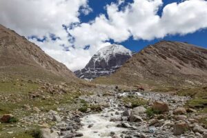
There are mountains famed for their height. And there are mountains famed for what they represent. At the western edge of the Tibetan Plateau, Mount Kailash (6,638 m) is one of the most influential sacred sites in Asia: a spiritual landmark for Hinduism, Tibetan Buddhism, Jainism and the Bon tradition.
For thousands of pilgrims, the aim is not to “conquer” the summit — climbing is in fact prohibited — but to complete a ritual circumambulation (kora or parikrama), interpreted as purification, spiritual merit or personal transformation. (Britannica; Wikipedia).
This guide is purely informative and aims to be as comprehensive as possible: history, religious significance, distances and “stages”, real level of difficulty, altitude, recommended season, permits, preparation and safety advice (without turning this into medical consultation), as well as an honest comparison with the Camino de Santiago to understand what changes when you undertake a pilgrimage in the high mountains.
If you are interested in exploring other pilgrimage routes around the world, Kailash is one of the great benchmarks for symbolism… and also one of the most demanding in terms of logistics.
Índice de contenidos
- 1 Why is it called “the centre of the universe”?
- 2 Where is Kailash and what makes it different from “a trek”?
- 3 A brief history: from sacred mountain to internationally recognised pilgrimage
- 4 What is the kora (parikrama): the heart of the journey
- 5 Distance, stages and typical route (outer kora in 3 days)
- 6 Real level of difficulty: who it is for (and who it is not)
- 7 When to go: climate, season and the weight of the cultural calendar
- 8 Permits, access and the current situation: what you need to know today
- 9 How people usually reach Darchen: the most common approach routes
- 10 Manasarovar: the sacred lake that completes the “Kailash universe”
- 11 Preparation and acclimatisation: how to increase your chances of enjoying the experience
- 12 What to bring: equipment checklist (with basic services in mind)
- 13 Cultural etiquette and respect: how not to intrude in a living sanctuary
- 14 Comparison: Kailash vs the Camino de Santiago (what truly changes)
- 15 A unique pilgrimage best understood before being idealised
Why is it called “the centre of the universe”?

When Kailash is described as the “centre of the universe”, this is not a scientific claim. It is an idea rooted in religious cosmology: in several Asian traditions there exists the concept of a “world-axis mountain” associated with the order of the cosmos (often linked to the myth of Mount Meru), a kind of symbolic pillar connecting the earthly and the sacred. Within this framework, this site is understood as an axial point — a place where the spiritual is “anchored” in geography.
This imagery is further reinforced by a much-cited geographical fact: in this region lie the headwaters or sources associated with some of Asia’s great rivers (such as the Indus, the Sutlej, the Brahmaputra/Yarlung Tsangpo and the Karnali/Ghaghara system), which has strengthened the perception of Kailash as a continental “knot”.
A sacred place for four religions (and not all pilgrimage in the same way)
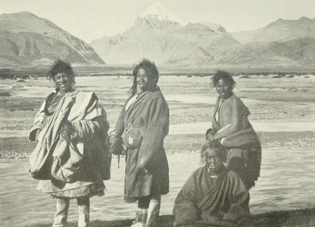
- Hinduism: regarded as the abode of Shiva. For many devotees, even “seeing” the mountain (darshan) already carries spiritual value.
- Tibetan Buddhism: incorporates Kailash into its sacred geography and into narratives linked to devotional practices and places of power.
- Jainism: the tradition associates it with Rishabhadeva (the first tirthankara) and his spiritual liberation.
- Bon: the indigenous Tibetan religion that predates the spread of Buddhism.
An important nuance that often surprises visitors: the circumambulation (kora/parikrama) is typically carried out clockwise by Hindus and Buddhists, whereas Jains and Bon practitioners perform it anticlockwise.
Where is Kailash and what makes it different from “a trek”?
Mount Kailash is located in Ngari Prefecture (Ali), in the west of the Tibet Autonomous Region, and forms part of the Gangdise Shan range (Transhimalaya). Its summit rises to 6,638 metres. The usual starting point for the pilgrimage is Darchen, a small high-altitude settlement that serves as the logistical “base”. From here, the outer kora both begins and ends.
What sets it apart from a classic trekking route? Above all, three factors:
- Sustained altitude: you walk for several days above 4,500 m.
- Ritual purpose: this is not a sporting circuit; for many, the kora is a devotional act.
- Limited infrastructure: basic accommodation and logistics shaped by permits and long distances.
A brief history: from sacred mountain to internationally recognised pilgrimage
The importance of Kailash was not “created” by modern tourism: its status as a sacred site dates back to ancient traditions of the Indian subcontinent and the Tibetan Plateau. Its sacred character spans different religions and is expressed through shared practices such as circumambulation (parikrama/kora), which has endured as the central rite.
In Tibetan and Transhimalayan imagination, it is also known by names such as Gang Rinpoche (in Tibetan, “Precious Snow Jewel”) and by other transliteration variants. This plurality of names reflects the fact that it is not a symbol of a single culture, but rather a point of convergence.
In contemporary terms, there is another key historical factor: access to this region has long been linked to border policies and permits. For instance, the pilgrimage of certain international groups was interrupted for years due to the COVID-19 pandemic and diplomatic tensions. Later, the resumption for Indian pilgrims was announced for 2025 as part of agreements and a thawing of relations.
What is the kora (parikrama): the heart of the journey
The kora is a ritual circumambulation around the mountain. The most common version is the outer kora, covering a distance of approximately 50–52 km and typically completed in 3 days by most walkers.
There is also an inner kora (less common), with shorter distances (for example, around 34 km) but more complex requirements and logistics. In many cases, it is regarded as a variant for pilgrims with more time, better acclimatisation or a specific ritual motivation.
Altitude: the factor that changes all the rules
The highest point of the outer kora is the Dolma La pass, at an altitude of 5,630 m. The circuit usually begins and ends in Darchen, situated at around 4,600 m. This has a practical consequence: Kailash is not “difficult” because of the distance, but because of hypoxia (reduced oxygen availability) and exposure to cold, wind and accumulated fatigue.
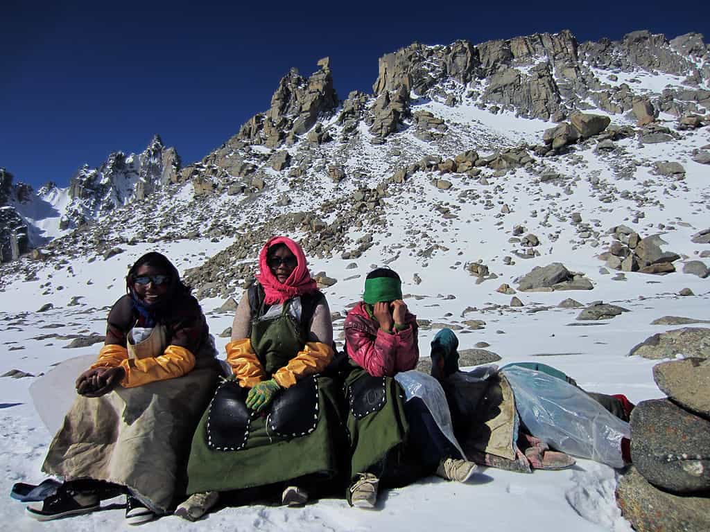
Ways of undertaking the pilgrimage: walking, animal support and prostrations
The standard way is on foot. The use of animal support (yak/pony) is also mentioned for certain sections or for carrying loads, depending on local availability.
In Tibetan Buddhism there is also an extreme form of pilgrimage: completing the kora through full-body prostrations, progressing by repeatedly kneeling and stretching out fully on the ground as a devotional practice and means of accumulating merit. General descriptions of Tibetan prostration explain this method (knees to the ground, body extended, arms outstretched), and literature on Kailash itself refers to this as the “most extreme” modality.
Distance, stages and typical route (outer kora in 3 days)
Although the experience is spiritual, in practice it is organised as a route divided into stages, with overnight stays at relatively fixed points. Below is the outer kora completed in 3 days, with approximate distances per section:
| Day | Usual section | Approximate distance | Key idea |
| 1 | Darchen → Dirapuk | ~13 km | A gradual start to find your rhythm and “read” how your body responds to altitude. |
| 2 | Dirapuk → Dolma La (5,630 m) → Zutulpuk | ~24 km | The most demanding day: ascent to the pass and a long descent. |
| 3 | Zutulpuk → Darchen | ~12 km | Completion of the circuit, with accumulated fatigue but less elevation change. |
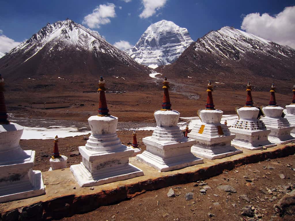
Landmarks along the route: what the pilgrim usually sees
Beyond simply “walking”, the kora unfolds as a succession of landscapes and symbolic points: wide valleys, stretches of moraine, prayer flags, mani stones, and two overnight areas associated with monasteries (Dirapuk and Zutulpuk). Dirapuk stands out for its visual proximity to the mountain’s north face, while the Dolma La pass marks the most intense physical and emotional moment of the journey.
Real level of difficulty: who it is for (and who it is not)
If we had to classify Kailash in hiking terms: it is not technical (it does not require climbing), but it can be tough due to the altitude and the long day over the pass. The effort is amplified because the body is working with less oxygen and because the weather can change rapidly.
The three factors that most often “break” the pilgrim
- Extreme altitude: the Dolma La pass falls within the “extreme altitude” range (above 5,500 m) according to standard medical classifications, requiring acclimatisation and caution.
- The pace of the second day: 24 km at altitude, with sustained ascent and a long descent, can make for a very long day for steady walkers.
- Basic infrastructure: rest, food and hygiene are generally more austere than on most European routes.
Altitude sickness: signs to watch for
Acute mountain sickness (AMS) is diagnosed by symptoms following a recent ascent: headache is the cardinal symptom and is often accompanied by nausea, dizziness, fatigue, loss of appetite or sleep disturbance. Symptoms usually appear between 2–12 hours (CDC) or 6–10 hours (NHS) after reaching high altitude.
A golden rule repeated in mountain medicine: if significant symptoms appear, you should not continue ascending, and if they worsen, descent and medical assistance take priority. In remote areas, delaying decisions can worsen the prognosis.
This does not replace medical advice: if you have cardiopulmonary history or any doubts, it is advisable to seek professional assessment before travelling.
When to go: climate, season and the weight of the cultural calendar
We recommend undertaking the experience between May and September, with variations depending on the year and accessibility. It may be extended to April–October, but practical consensus usually centres on the milder months with more stable road conditions.
Here, “summer” does not mean constant warmth: even in the favourable season, nights can be cold and windy. That is why layering, sun protection (due to radiation) and hydration are so frequently emphasised.
In addition, some pilgrims choose their dates according to Tibetan calendar festivals (for example, months with particular ritual significance). If this interests you, the practical recommendation is twofold: confirm the specific dates for the year (as the lunar calendar varies) and consider the logistical impact (more people, greater pressure on accommodation, etc.).
Permits, access and the current situation: what you need to know today
Travelling to Tibet as a foreigner does not operate like a “free” destination: permits are required, and the process is usually handled through authorised operators. For remote or sensitive areas (such as Ngari/Kailash), additional permits are often required alongside the Tibet Travel Permit, such as the Aliens’ Travel Permit and the Military Permit.
An up-to-date and relevant detail: although exemptions from the Aliens’ Travel Permit for several popular routes were announced from 2025, the Tibetan tourism sector itself emphasises that for the Ali route (Kailash–Manasarovar) additional permit requirements remain in place.
On the geopolitical level, the resumption of Indian pilgrimages in 2025 made international news: China announced it would allow the return of Indian pilgrims during the summer of 2025, after five years of suspension due to COVID-19 and border tensions.
Practical conclusion: the route is accessible, but the “operational” aspect changes far more than on European pilgrimages. To plan realistically, you must review current requirements, nationality conditions, the specific route and entry regulations.
How people usually reach Darchen: the most common approach routes
Access to Kailash normally combines a flight/entry into China, arrival in Lhasa (or other authorised points), and then an overland journey westwards. The most frequent itinerary is:
- Lhasa → Gyantse → Shigatse → Saga → Kailash/Darchen area → Lake Manasarovar
This pattern appears repeatedly in routes published by Tibetan operators and reflects two needs: progressive acclimatisation and covering the long distances of the plateau with logical stopovers. Many travellers also include a section of Everest Base Camp (Tibetan side) in extended itineraries, not so much to “add more”, but because the western route itself makes it possible in some plans.
Manasarovar: the sacred lake that completes the “Kailash universe”
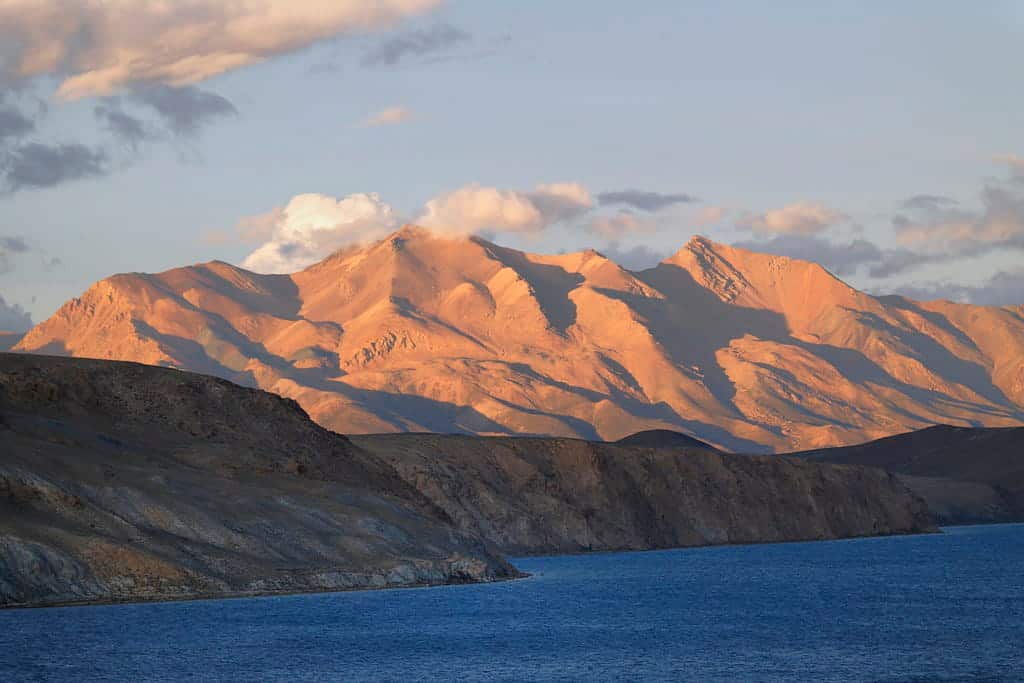
The pilgrimage to Kailash usually includes Lake Manasarovar (Mapam Yumtso), a nearby high-altitude lake considered sacred in several of the traditions linked to the mountain. It lies at approximately 4,588 m above sea level and is described as one of the highest freshwater lakes in Asia.
Beyond its symbolism, there is a practical reminder: being close to 4,600 m means the body is still in “altitude mode”, even on an apparently restful day. For that reason, the visit can be a beautiful moment… but it is unwise to turn it into an overexerting day if you are still acclimatising.
Preparation and acclimatisation: how to increase your chances of enjoying the experience
Acclimatisation is not a luxury: it is the difference between “a tough but manageable experience” and “a journey that forces you to abandon”. It is advisable to avoid alcohol and intense exercise during the first 48 hours after arriving at high altitude, and to apply strategies such as sleeping lower when possible or undertaking controlled ascents and descents.
Simple (and realistic) principles for Kailash
- Ascend gradually: overland itineraries with stops (Lhasa, Shigatse, Saga) help the body adapt.
- Go slowly: at altitude, “pushing hard” does not always mean “being fit”; AMS can affect anyone.
- Listen to symptoms: severe headache, intense nausea, confusion or breathing difficulty are not overcome by willpower.
- Hydration and rest: basic, but crucial.
Having been above 2,700–3,000 m in the preceding weeks may have a protective effect.
What to bring: equipment checklist (with basic services in mind)
Kailash does not require technical climbing gear, but it is essential to be prepared for cold, wind, solar radiation, dust and possible sudden changes. Practical list:
- Layered clothing: thermal base layer, mid-layer and windproof/waterproof outer layer.
- Sun protection: UV-filter sunglasses, high-factor sunscreen, cap or buff (radiation is very strong at altitude).
- Broken-in footwear: sturdy trekking boots or shoes, and suitable socks.
- Trekking poles: especially useful on the descent from the pass.
- Gloves and hat: even in “good weather” they can protect you from cold and wind.
- Water bottle or hydration system + salts (according to tolerance).
- Head torch: in case your pace requires adjusting schedules.
- Small first-aid kit: basic pain relief, plasters/blister prevention, and anything your doctor recommends if you have specific prescriptions.
- Snacks: logistics can be irregular and appetite decreases at altitude.
In basic accommodation, it may also help to bring: a sleeping bag liner, hygiene wipes and a small bottle of hand sanitiser.
Cultural etiquette and respect: how not to intrude in a living sanctuary
It is one thing to visit a landscape; it is another to enter a living sanctuary. Some simple guidelines:
- Observe before acting: if a ritual is taking place, respect silence and space.
- Photograph thoughtfully: not everything is “Instagrammable”; some areas carry restrictions or sensitivities.
- Leave no trace: at altitude, environmental impact is amplified (waste degrades more slowly).
- Respect the direction of the kora: for many it is not just any circular route; it is a rite with a specific direction.
And one powerful symbol of that respect: the mountain is considered sacred and the summit remains “untouched” in sporting terms; climbing is prohibited.
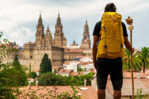
Comparison: Kailash vs the Camino de Santiago (what truly changes)
Kailash and the Camino de Santiago share something essential: walking with purpose. Yet they are experienced according to very different logics:
- Infrastructure and autonomy: on the Camino there is continuous waymarking, an extensive network of accommodation and services, and great flexibility to decide stages “on the go”. In Kailash, planning carries more weight due to permits, checkpoints and the relative scarcity of services.
- Main risk: on the Camino, the challenge usually lies in daily repetition (tendinitis, blisters, fatigue) and managing rest. In Kailash, the defining factor is altitude and exposure to harsher climates.
- Logistics: a pilgrim in Spain can easily adapt their route. In western Tibet, each decision carries greater “cost” (distances, roads, overnight points).
- Atmosphere: the Camino is often social, with a highly visible international pilgrim community. Kailash can be deeply communal in ritual terms, yet also more introspective and shaped by its environment.
If you need concrete examples of Camino routes to grasp the difference, at Mundiplus you will find very clear proposals by stages and services such as the Northern Way from Gijón, and sections of the French Way with well-established infrastructure and their own character, such as the French Way from Logroño and the French Way from Burgos. The point is not to decide which “is better”, but to understand that Kailash demands a different kind of preparation, safety margin and humility in the face of altitude.
A unique pilgrimage best understood before being idealised
The pilgrimage to Mount Kailash is unique because it combines extreme geography and living tradition within a single circuit: 50–52 km around a mountain sacred to four religions, with a pass at 5,630 m and an environment where symbolism coexists with real-world logistics (permits, long roads, basic infrastructure).
If you take away one idea: Kailash is not “more authentic” than other pilgrimages, but it is more delicate in terms of preparation and safety. And precisely for that reason, when undertaken with respect, acclimatisation and common sense, it often leaves a profound mark: for the landscape, for the ritual dimension, and for the honesty imposed by altitude.