For centuries, the California Mission Trail has connected missions, presidios, and towns along the west coast of the United States, from San Diego to Sonoma. A
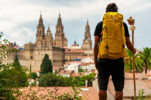
Although its original route had a religious and military purpose during the Viceroyalty of New Spain, today it is a cultural and heritage route that piques the curiosity of travellers from all over the world. Especially if you are already familiar with the Camino de Santiago and are looking for new routes with character.
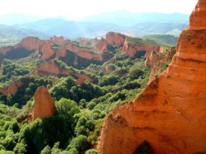
Over 1,000 kilometres, this itinerary traverses changing landscapes, urban areas, and natural spaces of great beauty. You can explore it in stages or adapt it to your schedule, with visits that combine history, colonial architecture, Californian cuisine, and the chance to delve into a lesser-known part of Hispanic identity in North America.
Índice de contenidos
A route with history and meaning for the traveller

The Camino Real was designed by the Franciscans in the late 18th century to link the 21 missions founded between 1769 and 1833. Each mission is separated by an average distance of 30 miles (about 48 kilometres), a journey designed to be walkable in a single day.
This approach is similar to other European religious routes. It is not surprising that more and more people associate it with their previous experience on a Camino de Santiago organised walk, adapting the stages depending on the time available and the focus they want to give it.
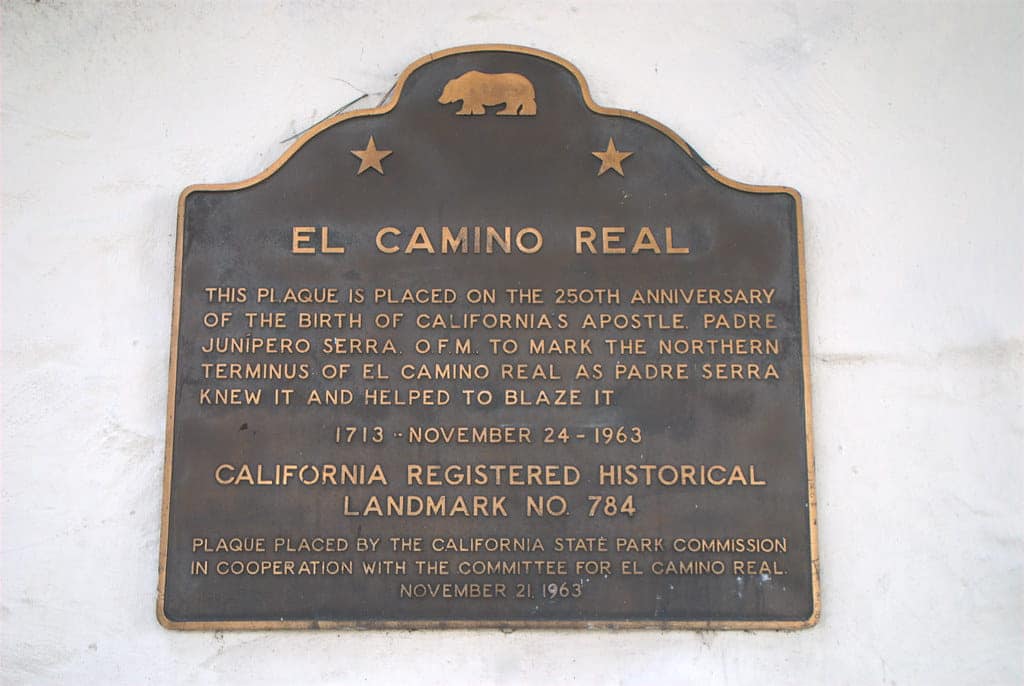
Although the original route has been lost in many areas, today you can still follow its path thanks to a recognisable signage: the bell of the Camino Real, installed on iron posts along the historic route. Through this symbolism, the memory of the path is kept alive, but also its value as a cultural network that connects the past and the present.
Whether you are interested in its heritage aspect or prefer to explore it as an alternative to the Camino in American territory, this option offers a flexible and enriching experience.
How is it similar to and different from the Camino de Santiago?
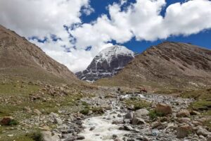
Although they originated in different historical contexts, the California Mission Trail and the Camino de Santiago share a common essence: the desire to travel a route with spiritual, cultural, and personal meaning. Both paths allow travellers to immerse themselves in changing landscapes, discover architecture with centuries of history, and connect with local communities that proudly preserve their heritage.
A notable difference is their international recognition. The Camino de Santiago, with routes like the Camino Ribadeo Santiago or the Camino Santiago from Bilbao, is protected by UNESCO and receives thousands of pilgrims each year. On the other hand, the Camino Real is a less crowded route, which can be an advantage if you’re looking for a more intimate and flexible experience.
Both share the possibility of walking them in stages, either on foot or with logistical support, although the Camino Real is more dependent on car or bike due to the limited continuity of pedestrian sections.
However, initiatives like the “Camino Real passport” or the recovery of old missions bring it closer to the Jacobean experience. In fact, some people combine their interest in these types of religious routes by first completing the Camino de Santiago —for example, from the Camino de Tui to Santiago— and then exploring alternatives in America with a similar motivation.
Missions, architecture, and curiosities of the trail
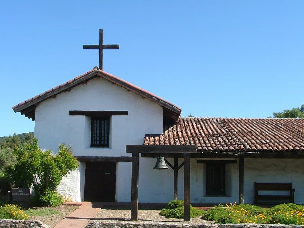
One of the most prominent features of the California Mission Trail are the missions, buildings that are still standing and can be visited with relative ease. Each one has its own history, though all share architecture based on adobe, inner courtyards, and a design adapted to the climatic conditions of each region.
The Mission San Juan Capistrano, for example, is one of the most visited, both for its aesthetics and the surrounding environment. Others, like the Mission San Antonio de Padua or the Mission Santa Barbara, offer quieter spaces and a less touristy atmosphere.
In addition to the missions, you can find remains of old presidios, sections of cobblestone paths, and rural churches. You will pass through small towns where the Hispanic presence is still evident in names, customs, and celebrations.
It is recommended to check the opening hours in advance, as some places hold religious activities or restrict access on specific days.
Itinerary of the California Mission Trail (from south to north)
- Origin: Mission San Diego de Alcalá (San Diego, CA)
- First mission founded (1769)
- → Mission San Luis Rey (Oceanside, CA)
- Distance: approx. 90 km
- → Mission San Juan Capistrano (San Juan Capistrano, CA)
- Distance: approx. 55 km
- → Mission San Gabriel Archangel (Los Angeles, CA)
- Distance: approx. 75 km
- → Mission San Fernando Rey de España (Mission Hills, CA)
- Distance: approx. 35 km
- → Mission San Buenaventura (Ventura, CA)
- Distance: approx. 105 km
- → Mission Santa Barbara (Santa Barbara, CA)
- Distance: approx. 50 km
- → Mission La Purísima Concepción (Lompoc, CA)
- Distance: approx. 80 km
- → Mission San Luis Obispo de Tolosa (San Luis Obispo, CA)
-
- Distance: approx. 95 km
- → Mission San Miguel Arcángel (San Miguel, CA)
- Distance: approx. 65 km
- → Mission San Antonio de Padua (Jolon, CA)
- Distance: approx. 55 km
- → Mission Nuestra Señora de la Soledad (Soledad, CA)
- Distance: approx. 65 km
- → Mission San Carlos Borromeo de Carmelo (Carmel-by-the-Sea, CA)
- Distance: approx. 60 km
- → Mission San Juan Bautista (San Juan Bautista, CA)
- Distance: approx. 55 km
- → Mission Santa Cruz (Santa Cruz, CA)
- Distance: approx. 50 km
- → Mission Santa Clara de Asís (Santa Clara, CA)
- Distance: approx. 55 km
- → Mission San José (Fremont, CA)
- Distance: approx. 35 km
- → Mission San Francisco de Asís (San Francisco, CA)
- Distance: approx. 65 km
- → Mission San Rafael Arcángel (San Rafael, CA)
- Distance: approx. 30 km
- → Mission San Francisco Solano (Sonoma, CA)
- Distance: approx. 45 km
How to plan your journey practically
The best way to explore the Camino Real depends on the time you have, your interest in walking, or whether you prefer to do it on foot, by car, or by bike. Although some sections are set up for hiking, most travellers opt for a mixed route that combines walking with transport.
You can use interactive maps, local guides, or even specialised agencies to help design your itinerary based on your interests. You will also find accommodations that offer discounts to those with a route plan or who link multiple missions on consecutive days, which is especially useful if you want to make the most of your time without sacrificing comfort.
It is recommended to bring comfortable clothing, sunscreen, and water, as some areas can be hot and services may not always be visible. Pack a printed or digital guide, and if you have internet access, check out hiking apps that include detailed maps of the missions and practical tips.
If you’re interested in the spiritual or historical focus, you can request a “Camino Real Passport” at certain tourist points, which allows you to record your visits and obtain additional information. It’s also a good idea to inform yourself about local festivals that may coincide with your visit to the missions, as these can enrich your experience and provide a more direct connection with the community.