The Camino Vadiniense is an ancient Jacobean route that connects the Cantabrian coast with the Castilian plateau, crossing the imposing Picos de Europa. It is a lesser-known pilgrimage route that has historically remained in the shadow of the popular Camino Francés and the Camino Lebaniego.
Even so, over the centuries many travellers and pilgrims have passed through its high-mountain landscapes, enjoying a unique experience among valleys, forests and Cantabrian peaks. Today, it offers a spectacular alternative for linking the Camino del Norte with the Camino Francés, providing landscapes of great ecological and cultural value.
Before going into detail, it should be clarified that this article is purely informative and that Mundiplus does not offer services on this route.
Índice de contenidos
History of the Camino Vadiniense
The origins of this route date back to the Middle Ages, when some pilgrims diverted their journey through the remote Liébana valley in search of safer routes than the exposed coastline. Although it never became firmly established as a main Jacobean route in the past (many walkers used it for local or religious purposes unrelated to Santiago), the Vadiniense served as a link between both routes.
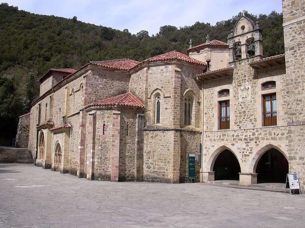
In fact, its initial stretch as far as Potes coincides with the centuries-old pilgrimage to the Monastery of Santo Toribio de Liébana, a sanctuary that houses the Lignum Crucis (the largest known fragment of the Cross of Christ), a sacred destination that has attracted crowds since the 8th century.
The name “Vadiniense” comes from the Vadinienses, an ancient Celtic people who inhabited this mountainous region in pre-Roman times. Their territory extended across western Cantabria, eastern Asturias and north-eastern León, precisely the geographical area through which the route runs.
The route fell into disuse for many centuries, until local associations and authorities undertook its recovery at the beginning of the 21st century. In particular, on the occasion of the Lebaniego Holy Year 2017, the entire route was once again fully signposted, revitalising its use by contemporary pilgrims.
Since then, although it remains a minority route, interest in the Camino Vadiniense has gradually grown. Today, it is still a hidden gem for lovers of mountains and solitude.
Route and stages of the Camino Vadiniense
The Camino Vadiniense covers approximately 200 km, divided into 9 stages, linking San Vicente de la Barquera (Cantabria), on the coast of the Cantabrian Sea, with Mansilla de las Mulas (very close to the city of León), on the Castilian plateau.
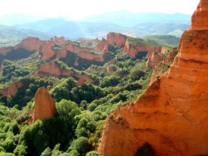
Along this route, the trail passes through landscapes of extraordinary beauty: it follows the course of the Deva river valley in Cantabria, ascends through the Picos de Europa to their eastern foothills and then descends through the Esla river valley in León. As mentioned above, during its first stages it shares the path with the Camino Lebaniego – which is why many pilgrims take the opportunity to visit the Monastery of Santo Toribio in Potes.
The complete Camino Vadiniense is usually divided into 10 stages, totalling approximately 210–215 km from the Cantabrian coast to the Leonese plateau. Below is a description of these stages and their main highlights:
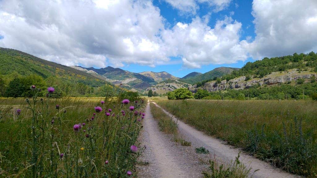
- Stage 1: San Vicente de la Barquera – Cades (24 km). The route begins by the sea, in the fishing town of San Vicente de la Barquera, leaving the Camino del Norte behind. From the beaches and the famous Gothic church of Santa María de los Ángeles, the route heads inland to the south through lush green valleys. The stage follows rural paths and forests in the Nansa river valley, passing small villages and old ironworks (traditional forges).
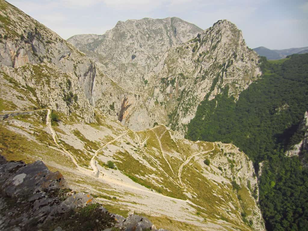
- Stage 2: Cades – Cicera (16 km). Short in distance but with significant elevation gain. The path climbs through oak forests and mountain pastures with ever-expanding views over the Deva valley. Midway, a high mountain pass offers views over the La Hermida Gorge, a spectacular canyon carved by the Deva River between limestone walls hundreds of metres high. Nearby stands the church of Santa María de Lebeña, a jewel of Cantabrian pre-Romanesque art (10th century), set at the foot of the rock face.
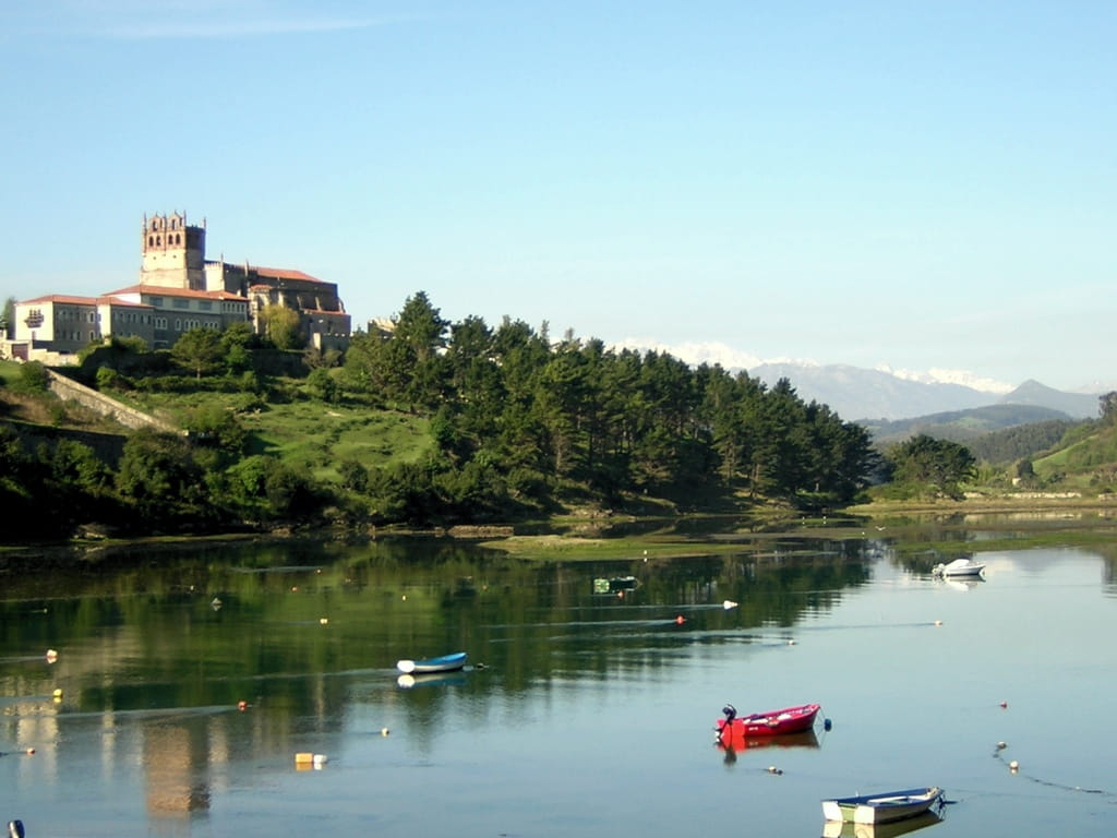
- Stage 3: Cicera – Potes (20.5 km). The path continues through the deep Liébana valley. After crossing the remainder of the La Hermida gorge and following the course of the Deva River, the route reaches Potes. This is a charming town, with a historic centre of cobbled streets and the Torre del Infantado dominating the skyline.
-
- Before finishing the stage, many pilgrims take the opportunity to visit the Monastery of Santo Toribio de Liébana, located about 3 km from Potes. This is where the Puerta del Perdón and the Lignum Crucis are found.
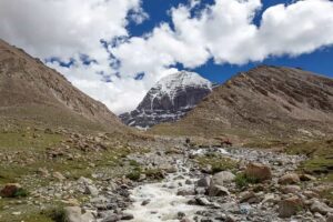
- Stage 4: Potes – Espinama (26.3 km). This stage enters the Picos de Europa, with imposing high-mountain scenery. The route passes small villages in the Camaleño valley and beech forests. Roughly halfway lies Fuente Dé, a famous tourist spot where a cable car ascends into the Picos (optionally, some pilgrims take the opportunity to go up and enjoy the views from above).
- Stage 5: Espinama – Portilla de la Reina (24.0 km). The queen stage of the route, featuring the toughest climb. The ascent follows mountain paths up to the Horcada de Valcavao (1,794 m above sea level), which marks the border between Cantabria and Castile and León. This is the highest point of the entire route, offering spectacular panoramic views. Along the way, the path crosses the Puerto de Pandetrave and provides views towards the Mampodre massif and other distant mountain ranges.
- Stage 6: Portilla de la Reina – Riaño (19.9 km). From here on, the stages become more manageable. The route continues descending alongside the Esla River through high-mountain meadows (brañas) and small mountain passes. The landscape opens up as the path approaches the Riaño Reservoir, a vast artificial lake surrounded by rugged peaks reflected in its waters. The views of the new Riaño (the village was rebuilt at a higher level after the construction of the reservoir in the 1980s) are breathtaking.
- Stage 7: Riaño – Crémenes (19.7 km). The route continues down the valley alongside the Esla River, entering the so-called Eastern Mountains of León. Alternating between stretches of secondary roads and footpaths, the route passes through oak forests and riverside meadows. This area is rich in historical remains: for example, near Crémenes you can see sections of the Roman Esla road, evidence of ancient trade routes.
- Stage 8: Crémenes – Cistierna (16.6 km). A relatively short and easy stage. The path runs through agricultural valleys and fields, leaving the highest mountains behind. The surroundings combine riverside landscapes with expanses of cereal crops as the route approaches the plateau.
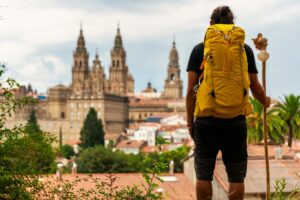
- Stage 9: Cistierna – Gradefes (22.8 km). The route passes through pastureland, riverside woods and small farming villages. The stage ends in Gradefes, a town known for its Monastery of Santa María la Real de Gradefes, a jewel of 12th-century Cistercian architecture. This former female monastery impresses with its simplicity and harmony, and is one of the last major cultural landmarks before joining the Camino Francés.
- Stage 10: Gradefes – Mansilla de las Mulas (23.1 km). Final stage. The terrain is now almost completely flat, crossing the Leonese plain along farm tracks and local roads. The route passes villages such as Villaverde de Sandoval (where remains of an old monastery can still be seen) and finally reaches Mansilla de las Mulas, a walled town that was an important point on the medieval Camino Francés.
Difficulty of the Camino Vadiniense
The Camino Vadiniense is considered one of the toughest routes in Spain within the Jacobean network. Its demanding elevation changes throughout the Cantabrian stages – with constant ascents and descents across mountainous terrain – mean it is primarily suited to pilgrims in good physical condition and accustomed to mountain hiking.
In Cantabria, the steepest ascents are concentrated, while once in León the profile softens considerably as the route follows river valleys. Despite reaching altitudes close to 1,800 metres when crossing the Cantabrian Range, the route does not include technically dangerous sections or exposed airy passages. Any walker with experience and due caution can complete it without the need for climbing equipment, although they must be prepared to face physically demanding stages.
Another factor to bear in mind is the solitude and limited services along the route. Given its recent revival and overall difficulty, it is very lightly travelled: for example, in 2021 only around 200 pilgrims walked it, a tiny figure compared with the tens of thousands on other routes. This low number of walkers means that accommodation and catering services are scarce on some stages.
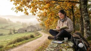
For this reason, it is advisable to plan stops and accommodation bookings in advance, and always carry some extra food and water in case supplies are not easily available. The reward for this logistical challenge is an experience of peace and connection with nature: many sections will be walked almost entirely alone, enjoying the silence of the mountains and the authenticity of rural life.
When is the best time to walk it?
Given the altitude and climate of these mountains, the best time to undertake the route is late spring, summer or early autumn. In winter, snow and ice at higher elevations are quite common (in places such as the Horcada de Valcavao, several metres of snow can accumulate), which makes passage difficult or even impossible. It is therefore recommended to avoid the coldest months unless you have appropriate equipment and experience in winter trekking.
Likewise, in the height of summer it is advisable to set off early and protect yourself well from the sun, as there are sections with little shade and the heat can add extra difficulty. In any case, carrying suitable equipment (technical clothing, mountain footwear, walking poles, plenty of water, etc.) is essential to enjoy this adventure safely.
Waymarking of the Camino Vadiniense
The waymarking of this route has improved significantly in recent years. After having remained almost forgotten, it was signposted again in 2017 to coincide with the Lebaniego Holy Year, restoring the continuity of its official markers and signs.
At present, from San Vicente de la Barquera to Santo Toribio de Liébana the route follows the specific signage of the Camino Lebaniego: you will find red arrows painted along the way and symbols of the red cross on a white background guiding you to the monastery. From Santo Toribio (near Potes) onwards, the Vadiniense adopts the classic yellow arrows and scallop shells of the Camino de Santiago, making the Jacobean route easy to recognise from that point.
In general terms, in Cantabria the waymarking is very good and plentiful, thanks to the institutional effort made at the time. Once in the province of León, some sections are perfectly marked, while in others the signage may be sparse or confusing. This requires the pilgrim to pay a little more attention to the map or guide, especially at junctions.
Nevertheless, these occasional doubts do not pose a serious problem when completing the route. With a good map (or GPS) and by asking locals if in doubt, it is possible to find your way without too much difficulty.
The Camino Vadiniense compared with other Jacobean routes
Within the broad mosaic of Camino de Santiago routes, the Vadiniense occupies a particular place as a connecting itinerary between major paths. Unlike the main routes, it offers isolation, high mountains and a physical challenge. It also contrasts with the historic Camino Primitivo, which, although it shares mountainous surroundings and lower footfall, has a more deeply rooted Jacobean tradition and a considerably shorter length.
Other well-known routes, such as the Camino Inglés or the Vía de la Plata, provide different experiences (shorter distances in the case of the Camino Inglés, or very long routes with extreme climates in the case of the Vía de la Plata). In this context, the Vadiniense presents itself as an ideal alternative for those who wish to explore less-travelled variants.
Fortunately, there are numerous Camino de Santiago alternatives beyond the traditional French Route, each with its own appeal. For example:
- The Camino de Santiago from Porto allows pilgrims to start their journey in Portugal, crossing coastal and inland Portuguese landscapes before entering Galicia. With a fairly flat profile, it also offers the opportunity to discover two countries.
- Another distinctive option is the Spiritual Variant of the Camino, in the province of Pontevedra, a route that adds a mystical touch by including a boat journey along the Ría de Arousa, retracing the historic transfer of the Apostle’s body.
- Likewise, the Sanabrés Route from Ourense to Santiago covers the final stages of the Vía de la Plata, offering a quieter way to reach Compostela through the interior of Galicia. It is also less busy and presents a level of difficulty midway between the Portuguese Route and the Vadiniense.
The Camino Vadiniense is a fascinating and demanding route that combines historical heritage, high-mountain adventure and the tranquillity of lesser-explored paths. If you are looking to experience the Camino de Santiago from a different perspective – surrounded by peaks, solitary valleys and ancient trails – this alternative route between the Picos de Europa and the Cantabrian coast can offer you an unforgettable journey towards Santiago.